
The Quilatoa Loop is a beautiful hike in the Ecuadorian Andes that leads to the flooded crater of the Volcano Quilatoa. We planned to do the ‘classic’ section of the loop following the route: Sigchos to Isinlivi (day 1), Isinlivi to Chugchilan (day 2), Chugchilan to Quilotoa (day 3).

This is around 20 miles in total. This might not seem too much over three days but don’t underestimate it, this hike is hard. There are 2152 meters (7,060 feet) of ascent and 1184 meters (3884 feet) total of descent across those three days and on the final day, you’re hiking at an altitude of 3900 meters (12,800 feet) with only 60% of the available oxygen compared to sea level. All that said, if you get the chance to do this hike, go for it. It is a fabulous trail and very rewarding.
The trail can also be walked in a reverse direction, starting at Quilatoa, to reduce the ascents, generally going down in altitude all the way, but this just didn’t seem right to us. The whole point of the hike is the goal, the reward at the end.
Leaving from Latacunga and preparation
The bus ride is around two hours from Latacunga to Sigchos and we took the 9.30am bus for our first day on the Loop. More about Latacunga in this post: Ecuador: Latacunga, ready for the Quilatoa Loop
A few things that may help if you are planning to walk the loop;
• Leave your bags in Latacunga. We stayed at the Hostel Cafe Tiana and they will store bags/rucksacks for $1 per day. We had daysacks packed in our main rucksacks and so left the heavy rucksacks and just brought what we needed for the hike, the essentials, valuables etc.
• Sort out a map/route. Everything you read about the Quilatoa Loop says you will get lost at some point. This is absolutely true! Don’t expect the route to be fully signposted all the way and some paths meet others and it can be pretty tricky to work out which way to go. While I was reading about this before we left I found a great route map for use with maps.me. Here it is: Quilatoa Loop Route Map
This is from another great blog you might want to look at for the Quilatoa Loop, The Practical Vagabonds.
Maps.me is great as it is an off-line map, no need for a mobile signal. We found it really helpful for knowing if, and when, we had strayed off the track.
• Get acclimatised. The altitude does really make a difference. There are some pretty steep slopes!
• A hiking stick isn’t a bad idea, we had heard about dogs along the way and only had one experience that got a little worrying with a barky dog, but a good waving of the walking stick in his direction seemed to help.
• Check your travel insurance. We struggled to find any that would cover us for hiking at 3,900 meters. Even most extreme sports ones still only covered hiking up to 3,500 meters. Even though that did cover us for ‘elephant polo’ too!
Day 1: Sigchos to Isinlivi ~ Around 4 hours hiking (6 miles)
Once we got off the bus there were a few people that seemed like they were walking the Loop too. They all seemed to fall into two distinct categories. People that got off the bus and set off in a direction like they were on a mission, but not all in the same direction… and then the second category, which included us. The handful of people that looked a little bewildered and lost. Where did we even start from? We chatted to a German woman who was also walking to loop and compared printed directions that we both had. We walked together for a while going through the town, she stayed a little while in the town getting supplies and we continued to wander through Sigchos. Already the off-line Maps.me Map on the phone was pointing us in the right direction, and so we found the start of the trail.

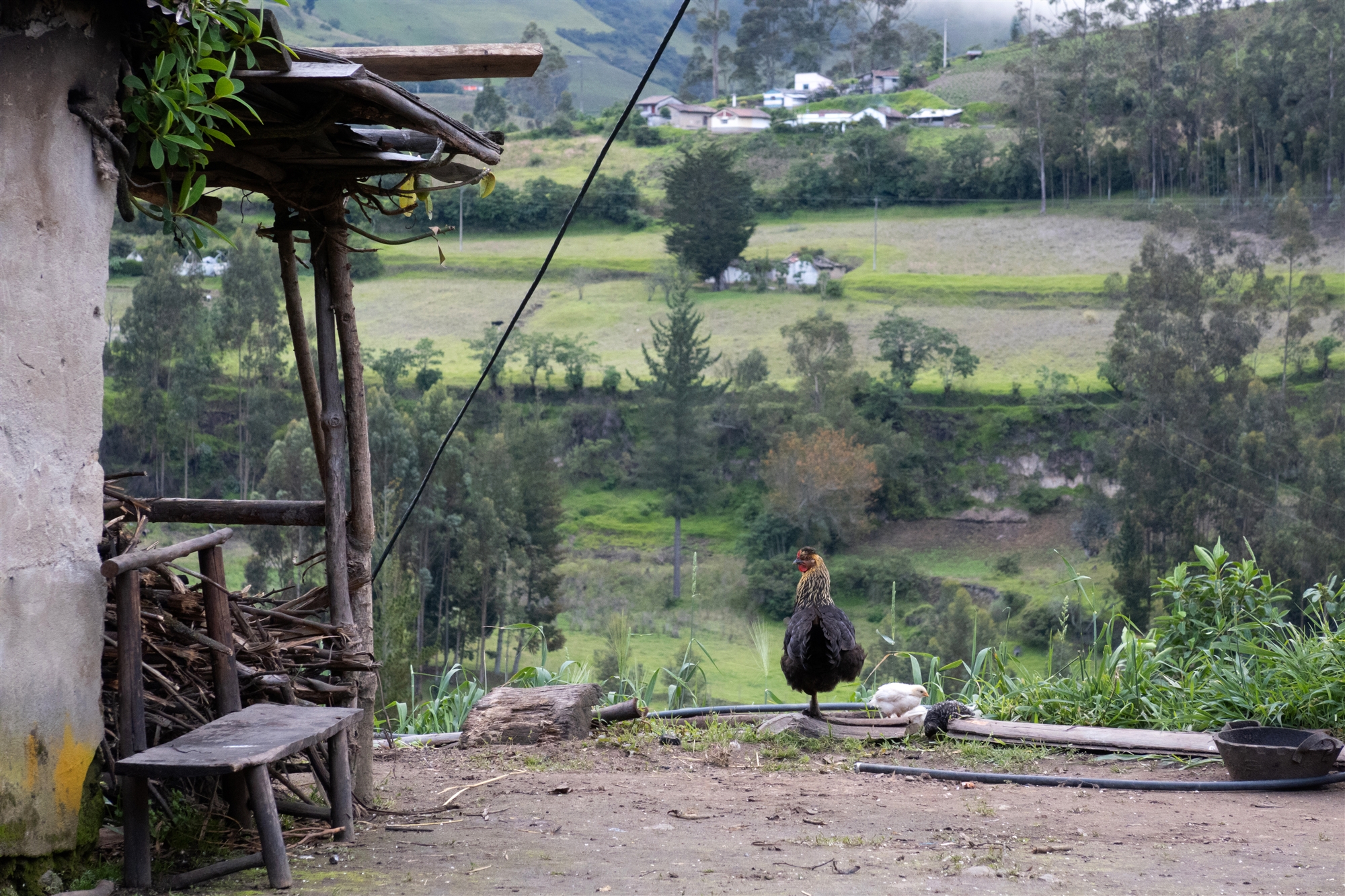
The Hostels have caught onto the idea that making the trail popular is good for them and so there are quite a few of the red and yellow signs along the way with Hostel names on them. It was really good to then get out into the open air and take in the views too.


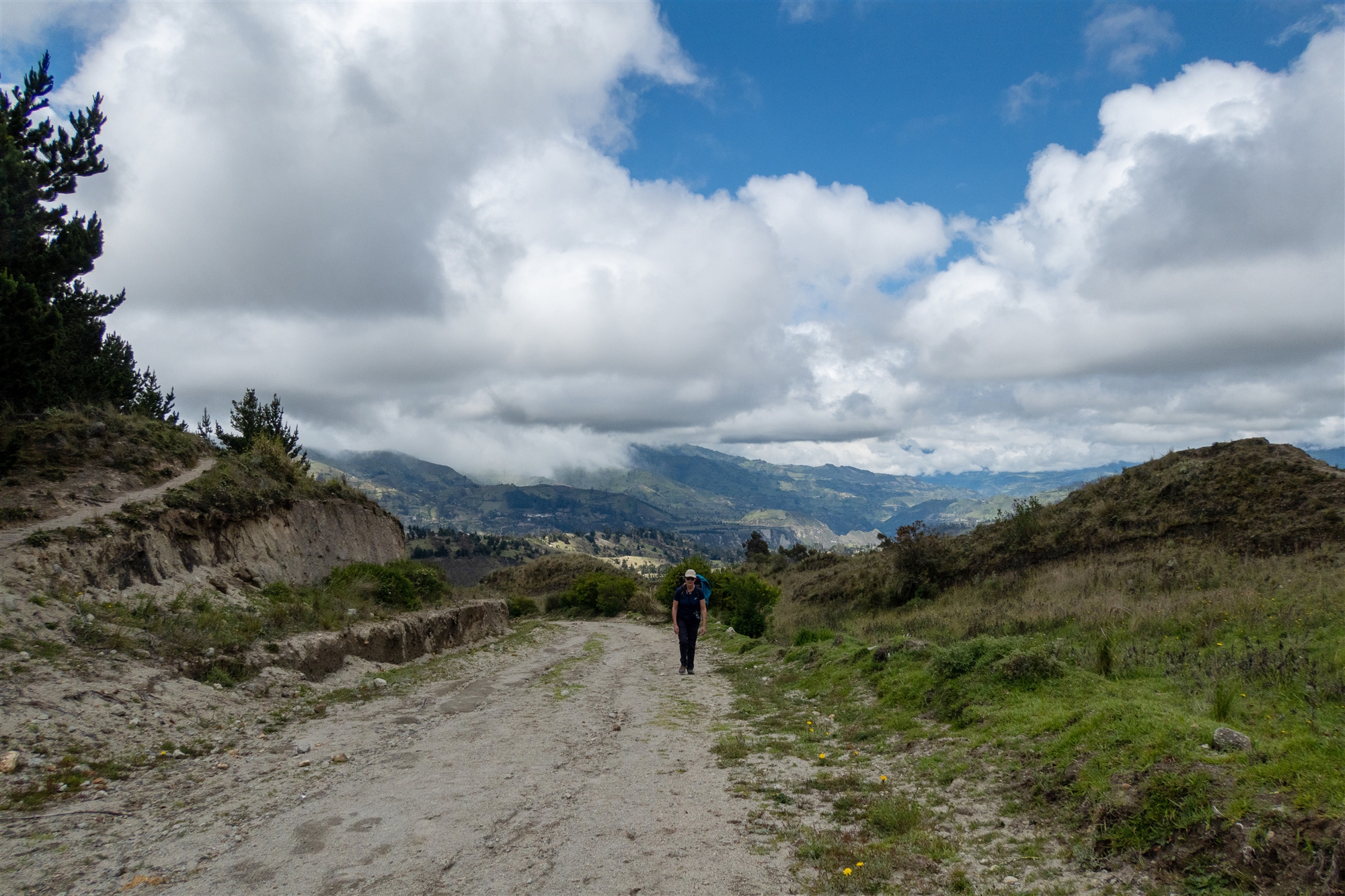
We were now at 2,900 meters (9,500 feet) above sea level and could feel it making a difference to the hiking. Everything we had read had said don’t underestimate hiking at altitude. Anything over 2,500 meters (around 8000 feet) is considered ‘at altitude’, and it’s very true. We both became out of breath quickly on the steeper slopes… of which there were plenty!

The trail is a mixture of tracks, dirt roads and walkways, but a really enjoyable walk. We saw a few people along the way, a mixture of locals and people doing the loop, but not too many and so had the trail to ourselves for most of the day. Eventually we caught sight of Isinlivi across a ravine.

Ahh just in sight, not too far at all then we thought! Don’t be fooled, this is a little misleading as you have to walk around the ravine to get to the village. We were still happy to be nearing the hostel as it had been hot and sticky days walking and the boots were ready to be off for sure. We had booked into Llullu Llama as we’d heard this was a really good hostel. It certainly looked good. The chap booking us in took out details and then leaned forward over the desk and said in a very quiet voice “we have one mountain room available tonight, a private room with a balcony and a log burner”… Here we go we thought, how much extra does he think we’re going to pay for that…
“It is free and empty tonight, so you can have it for the same price as the normal room, as long as you promise not to tell any of the other guests” he said! Well, that was a great start, yes please. He then led us through a common area with sofas and tables onto our room which was fabulous.

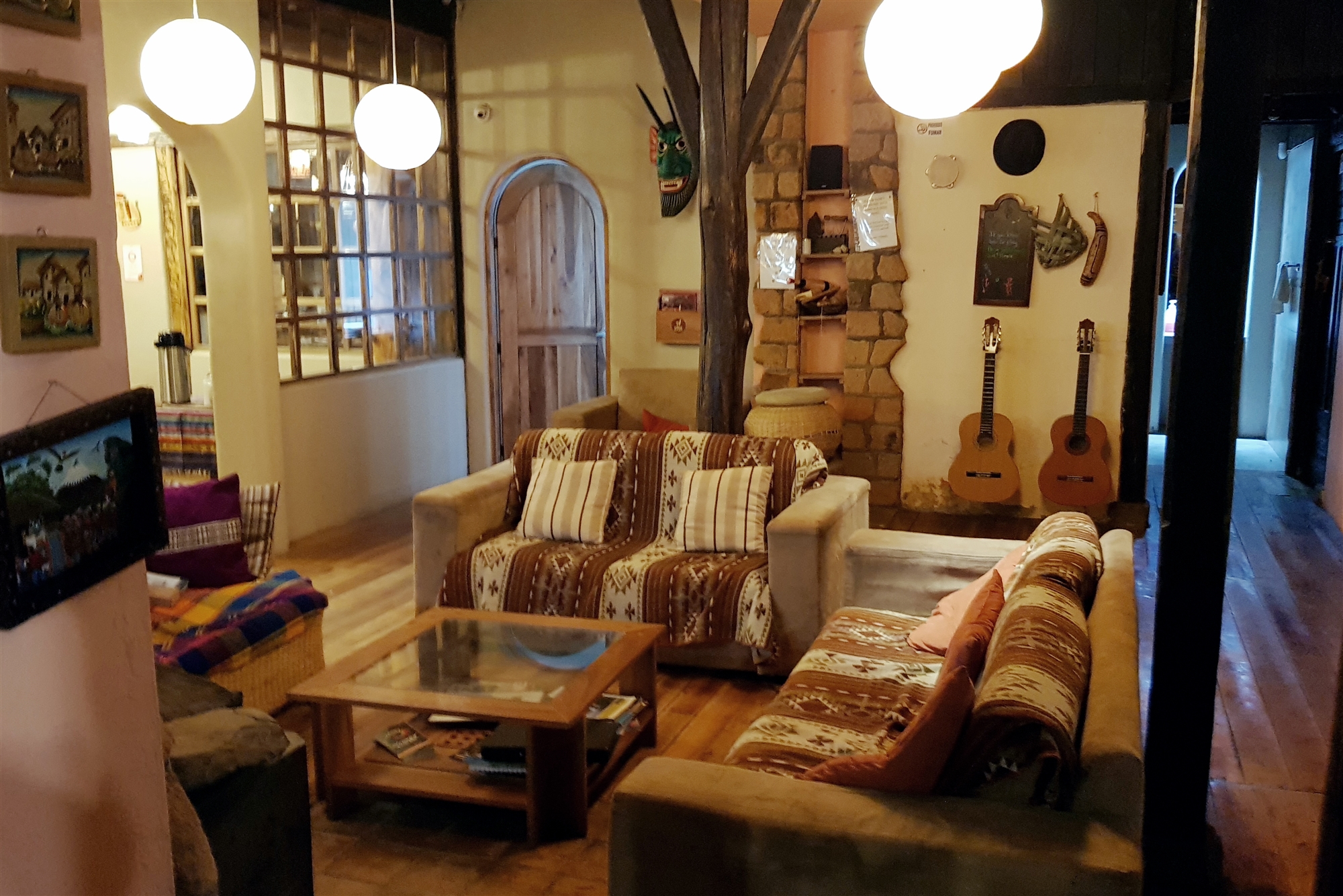


A welcome hammock and a great view. When it was time to eat we found the food was also great. Unsurprisingly the majority of people were in their 20’s and 30’s but there were a few older people in their 40’s and 50’s too. It was great to be immersed in all the stories of everyone’s journeys, from where they had come and to where they were heading to next. We got talking to a group of three women in their 20’s who were walking the loop and deciding where to head to after that. They were very bubbly and lots of fun, the German lady we’d spoken to at the start of our day also joined us, she was quite interesting person who travelled on her own for several months a year. We knew we wanted an early-ish start and so went back to our room and did light the log burner. It can get a little chilly at night high up in the mountains and the log burner was a welcome treat.
Llullu Llama we would highly recommended. Great people, food, location, and there is a bloody great big Saint Bernard and a Lama who seem to be the best of friends. What more could you want?
This is a part of the trip I would recommend to anyone, the hostels. We only had four nights in Hostals on our trip but the sense of camaraderie and banter was great. Certainly something we’d like to do again and more of.
Day 2: Isinlivi to Chugchilan ~ Around 5 to 6 hours hiking (8 miles)
Once up and a good breakfast of granola, fresh fruit, yoghurt followed by plenty of scrambled eggs we were ready to go. At 2,700 meters Isinlivi is actually one of the lowest altitude points on the loop and another day there would have been fabulous. But we had all our days planned out and so had to move on. The views of the clouds lifting and dissolving from the mountain tops first thing was a gorgeous way to start the day.


We knew the three girls were staying at the same hostel as us in Chugchilan but also knew their pace would be way quicker than ours so expected not to see too much of them on the hike. We set off knowing this day was going to be harder than the first. After blindly following a small group of walkers with a guide and pony carrying water for them for too long we realised they were not walking the same route as us. After a bit of backtracking, and frowning at the map we found our way onto the right track. We followed some twists and turns down some high sided pathways which opened up to some stunning views down the valley.
If being out in the open air and hiking is something you enjoy, then the Quilatoa Loop is well worth doing and a fabulous way to take in the scenery Ecuador has to offer.
We continued higher up along a dusty trail which then led onto some interesting narrow and steep gullies and descending into the valley. I enjoyed walking through these gullies, the cover from the sun and a complete change in walking style was quite welcome. We eventually came out still quite high up on the steep lush mountainside. We could see the river far below us and knew we were following the side of the mountain to meet the river below somewhere ahead of us.


At this point we spotted the girls down by the river, we shouted and waved just to say ‘Hi’ but they stopped and were doing lots of waving back. They started to climb the bank towards us and as they got nearer we could hear them shouting that they were lost. After a bit of a scramble they got to the track we were on and told us they had been lost for the last hour, but they were all in very good spirits. We showed them the map we had and which way we were heading, they said thanks and headed off at a pace, that again, was faster than ours.


We gradually descended down to the valley floor and the river. By this time the heat was quite intense. We walked for a while and then found the shade of a tree to flop under and have dinner. We had ordered a packed lunch from Lulu Lama which was great. It was ham and cheese with a few pieces of fruit. Very welcome at this point and we stayed a while to rest from the sun. The walk along the river is lovely but at some point you do need to cross it. This is done by a large tree trunk bridge with a few planks nailed to the side and a bit of wobbly wire for your balance.


We gradually started to come out of the valley and passed through a small village called Itualo. There was a little church and school, with school kids out for lunch. A little way past the village on the track there is a little hut and a little old lady selling bottles of water. We bought a couple of bottles for $1 a bottle and she gave us a banana to go with it too. As we turned and followed the trail we realised that in the confusion of taking off rucksacks and getting money out we had actually both paid her for the water! Not bad for two bottles of water. But to be fair Ecuador is a pretty poor country in many respects and if you look like a Gringo (or European) then an awful lot of things turn out to cost a nice round $1. But that’s fine, it’s just part of the trip and we never felt like anyone was ever trying it on or taking advantage either.
Soon after this, it became very apparent that the problem with descending into a deep valley is sooner or later, you then need to get out of it. Ahead of us the track zig-zagged upwards steeply to the valley ridge above us. There wasn’t much conversation during this section, but there was some random cursing and shaking of heads as a young local chap in a shirt and shoes actually came running down the track past us, running! If you imagine two arthritic tortoises making their way through treacle then you have a pretty good idea of our pace for this section. I won’t lie, this bit is pretty tough. The altitude just makes you so breathless so quickly. We were now at 3,170 meters (10,400 feet) above sea level. There was much cursing as we got higher and Anna did mutter a bit about feeling like she was about ready to die at one point… But after quite a few stops, to take in the view obviously… we made it.


At the top a small Ecuadorian man pointed us to the viewing point (Mirador) that is a kind of U-turn at the top of the track. And the view was stunning! As we took in the view there the rain started to come in but it wasn’t too heavy. We spoke for a while to the man, he said he had been watching us slowly climb and told us how as a child he had gone to the school at the bottom of the valley and that every day he’d gone down and then back up the climb we had just done. It is safe to say we were pretty impressed with just how fit so many Ecuadorians are, a function of the landscape it seems. He was an artist and had set up a stall just at the top of the track but that seemed fine too. We purchased a lovely little painted wood carving of a scene, the local people are just so polite that it never seems like a hard sell and made us more inclined to look.
Just after this we passed some amazing shapes in the hillside where the wind and rain had eroded it away. That was one thing we realised about the Andes from what we saw of it, how soft and changing it all is. There was so much of the landscape that was made up of rich soil and small rocks compressed together, so many landslips and sunken dips that made you realise that was very different to the solid granite of the Alps or Yosemite.


We passed some little houses and then after a little while longer reached a hill that became a road. This seemed to go on forever. Once on this hill, it was around another 40 mins to the hostel. We were by this time ready to just flop at the hostel, the climb out of the valley had knocked it out of us. As we reached the entrance to the Hostel we got a reception of shouts and applause from the girls we’d met back in Llullu Llama in Isinlivi. Even though they had gotten lost they had still arrived here in good time to be on the balcony with a beer by the time we plodded in.
We had booked in at the Cloud Forest Hostel which was great. The hill leads directly to it and you kind of pass it double back to get to the entrance so it’s pretty easy to find. The food was the standard deep-fried chicken and rice but was very welcome. The room was also good and there was an abundance of hammocks too.

It had been a pretty hard day but very rewarding. We hit our bed for some well-earned rest ready for our goal, Quilatoa, tomorrow.
Day 3: Chugchilan to Quilatoa ~ Around 6 hours hiking (8 miles)
After a good breakfast and a chat with the people we’d met over the past few days, including the bubbly boisterous trio of girls, we were ready to go. The hostels are great for this, good food to set you on your way.

We walked along a dirt track road for some way which led past some farms and then into a steep upwards gully. This continued up, and occasionally down for some time and at one point, we met a local man on a very nimble pony along part of this gully.
Just after this, we did meet one farmer who talked to us for a few minutes and then announced it was his land we were walking through and we’d need to pay him $1 each. Slightly annoying as I’m absolutely sure he was trying it on but just not worth the uncomfortable argument for $2.


Again we met very few people out walking. and this eventually opened out to a fabulous valley. This part of the hike was simply stunning, and rather than walking down and then back up the valley, we were walking along the length of it. Result!
It was hot but a fabulous part of the walk, right up until the point we realised we did indeed have to decent at the end of the valley to the stream at the very bottom, then climb back up again. Bugger!


We saw some shepherds jumping along the rocks chasing sheep as we climbed back out of the valley and realised at this point we could see the rim of Quilotoa ahead of us.
I can safely say this is the hardest hike I have ever done. Anna says she totally agrees with me on this. Once again the altitude did its evil work (and the fact we’re both over 50 probably didn’t help). We were now approaching 3,900 meters (12,800 feet) so for a good hour or two we had to stop every 50 meters or so and get our breath. There is only 60% of the oxygen at sea level at this altitude. We shuffled slowly but determinedly onwards. The dusty trail that led us upward seemed relentless. We had both slowed and fallen into two different methods at this point. Anna’s we called the ‘mini-plod’. This involved small steps, plodding along for 20 or 30 metes, then a stop for a breather, and on again. My pace we referred to as the ‘micro-plod’, this involved me plodding with even smaller steps, but relentlessly onwards. And somehow this meant we kept pace with each other, continually passing one another with a nod. No breath to spare for word at this point!


It became cooler as we neared the top and the clouds seemed to be coming in. We feared that after all of this we may not see the crater as the clouds dropped.
Then at last we turned the last corner and there it was, the 3km lake in the volcano crater! To say we were a bit happy after three days full on hiking would be an understatement!


After resting and having lunch at the rim we moved on. To get the bus we had to walk halfway around the rim of the crater. All of our focus had been on getting to the top so the trail around the rim was an unwelcome addition.
Picture the scene, the cloud cover is coming in, we’re about halfway around the rim and come to a part of the trail that was getting very narrow, single file, with a very long sheer drop on one side and a vertical wall on the other… after a quick discussion we both agreed going back wasn’t an option and that neither of us had any shame at all! We were going to crawl this bit… slowly. I went first and after 10 meters or so of the narrow scary bit, it widened out somewhat, and so I stood up. Only to see an elderly Ecuadorian couple watching with a smirk of despair. Obviously by this time Anna was now shuffling on her knees, concentrating on the path before her… I looked from the elderly couple, to Anna, and back again. Once Anna was back on her feet she had the same reaction as me, utter embarrassment. So we nodded and smiled in a very sheepish way at them. They nodded back to us and walked confidently right over the narrow gap without any hesitation at all. A bit embarrassing for us but it must have given them a good laugh anyway!
We were not quite sure where we were staying that night, we’d left it open-ended in case we finished later and needed to stay in Quilatoa. But it was early enough that we headed in the direction of the bus station to try and get back to Latacunga. As we neared the edge of the town we saw a taxi and both decided we were happy to get to the bus station that way. The taxi driver knew the time of the next bus and so made the journey quite speedy, and we just got to the bus station in time for the bus back to Latacunga. We arrived not knowing where we were going to stay and so first checked at Hostel Cafe Tiana, where we had left the rucksacks. They had a spare room free so that fell into place wonderfully. We got washed and there was a lovely bar and restaurant over the road, we figured we’d earned it at this point. A cracking end to the day.


We then had a couple of days to relax and recover before our next leg of the journey, five days in the Amazon rainforest!
My partner Anna has also been blogging about the Quilotoa Loop too, click here to have a read
~ Ian Andrew
